Dove sono in Finlandia:
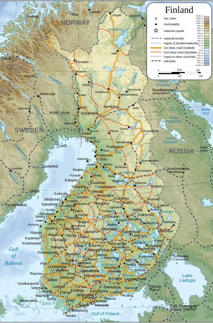 In questa cartina fisica si puo’ vedere chiaramente che il territorio Finlandese è dotato di pochi rilievi; le montagne piu’ alte superano a malapena i 1.300 metri. Questo perche’ si tratta di un territorio antico, formatosi in ere molto anteriori alla nostra penisola. Ciò non significa che sia completamente piatto: per la verità è molto scollinato e ci si rende conto di questo non appena si sale su una bicicletta e si inizia a pedalare!
Il Paese è ricoperto di foreste di conifere, alternate a betulle, ontani e, nell’estremo sud, pioppi tremuli e frassini. L’agricoltura è molto presente, prevalentemente cerealicola. Una grossa parte di territorio è occupata dai 188.000 laghi.
I centri maggiori sono: Helsinki, la capitale; Turku, capitale del Paese fino ai primi dell’800; Tampere, città industriale; Oulu e Rovaniemi, alle porte della Lapponia. A Rovaniemi si trova anche il Santa Claus’ Village, con l’Official Post Office, centro di smistamento postale di tutte le letterine al Babbo che arrivano qui da ogni parte del mondo.
La residenza ufficiale di Babbo Natale comunque, luogo impervio e segretissimo, è la montagna di Korvatunturi, nel nord-est del Paese. Il nome significa letteralmente: “Monte dell’orecchio”, poiche’ il Babbo “ascolta” le preghierine di tutti i bambini. Questa storia, che Risto mi ha raccontato agli albori della nostra conoscenza, è nel cuore di ogni bimbo Finlandese.
In questa seconda cartina, ci si rende conto della posizione di Somero: nell’estremo sud del Paese e praticamente equidistante dalle maggiori citta’ : 80 km circa da Turku e un centinaio da Helsinki e Tampere. Vicino a Somero, i centri piu’ popolosi sono Salo e Forssa, entrambi contano circa 20.000 abitanti, mentre Somero ne ha 10.000.
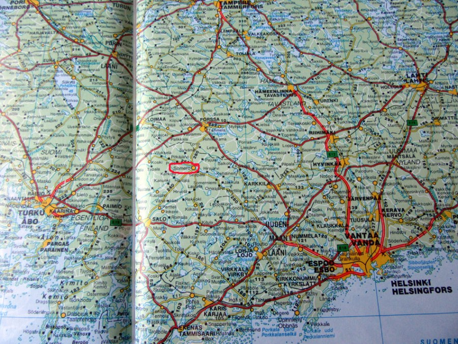
 Il rapporto fra la superficie dei centri abitati e il numero di abitanti qui e’ totalmente diverso che in Italia: il territorio e’ ampio e scarsamente popolato.
Where I am in Finland:
In the first map above you can have a general idea of Finland as a country. As you can see, there aren’t many mountains, but a lot of hills and you realize the territory is not flat whenever you take a bike! The highest fells in Lapland are scrcely 1,300 metres high, as the territory is very ancient.
A large part of the territory is covered by forests: mainly pine, spruce, birch, European aspen and alder forests. The circa 188,000 lakes are also a remarkable view on the map: mainly in the eastern part of the country. Agriculture is a primary activity, producing mostly cereals.
Finland’s major cities are: Helsinki, the capital town; Turku, the old capital; Tampere, a big industrial town; Oulu and Rovaniemi at the gateway of Lapland. Rovaniemi is worldwide famous for being the official Main Post office of Santa Claus: the place where letters of all children in the world are sorted through. Santa’s own dwelling place, though, is not in Rovaniemi, but in a secluded area in the Korvatunturi fell, more in the north-east; the name of this place in Finnish language means: “The ear mountain”, as Santa listens to children’s prayers. This story of Santa’s real home is among what my husband told me when we first met and it is cherished by every Finnish child.
In the second and third maps above, you can have an idea of the location of Somero, in the southern part of the country; at a comfortable distance from the major cities. Somero has roughly 10 thousand inhabitants and the closest bigger towns are: Salo and Forssa, with about 20 thousand. The population density in Finland is quite low, especially in the northern areas; it happens that towns are large but scarcely inhabited.
***
Dove sono in Europa – Where I am in Europe:
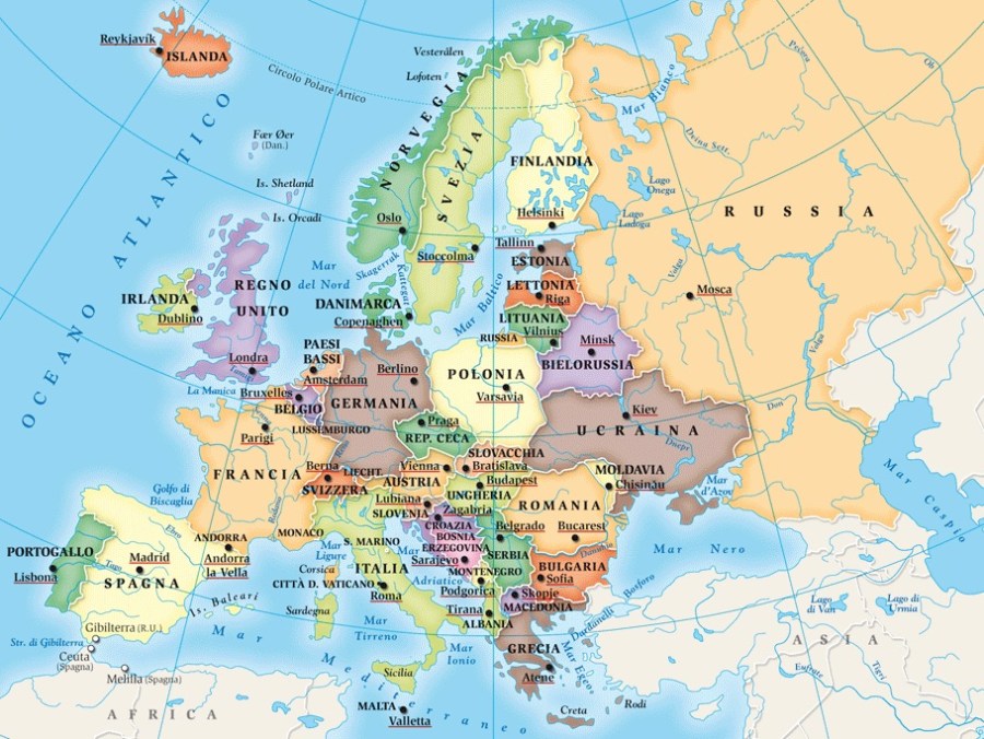
Come vedete dalla piantina del continente europeo, l’Italia si trova all’estremo sud, mentre la Finlandia all’estremo nord-est. Fra i due paesi ci sono 2000 km in linea d’aria e un’ora di fuso orario: la Finlandia ha un’ora in piu’.
You can see in this general map of Europe how Italy is in the south whereas Finland is in the north-east of the continent: as the crow flies, there are 2000 km distance between the two. Their time zone is also different: Finland is UTC+2 and Italy is UTC+1.
***
Dove sono in Italia:
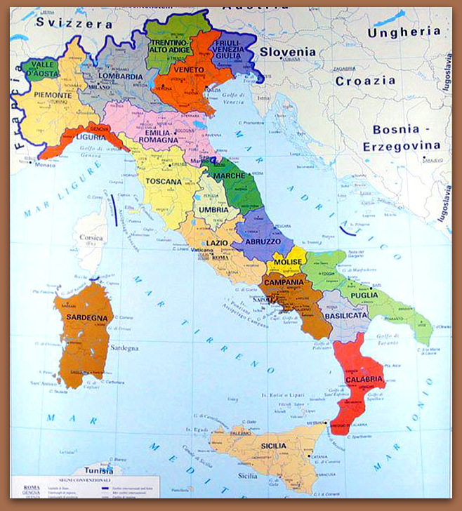
L’Italia e’ un Paese conosciutissimo nel mondo per ragioni turistiche, artistiche, gastronomiche e lo e’ senz’altro anche la mia citta’: Verona; tuttavia ho ritenuto di mettere nel blog anche una cartina dell’Italia soprattutto per visualizzare dove si trova esattamente Verona, per aiutare coloro per i quali la geografia e’ un punto debole. La citta’ dove abito quando sono in Italia, si trova nel nord-est del Paese, nella regione Veneto ed e’ affacciata sulla sponda dx del lago di Garda. Del comprensorio di Verona fanno parte anche i Monti Lessini, la cui cima maggiore, il Monte Baldo, e’ alto circa 2000 mt. Il territorio e’ quindi vario: dalla pianura Padana alle montagne.
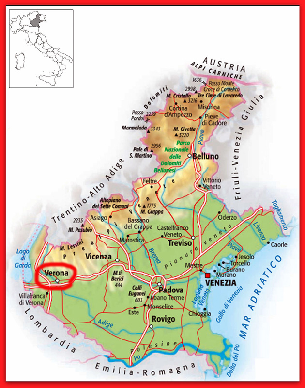
Verona e’ una provincia con molte possibilita’ turistiche grazie anche al suo clima: questo i finlandesi lo sanno bene e sin dagli anni ’70 i voli charter estivi hanno portato a Verona o sul Garda migliaia di loro. La citta’ conta circa 250.000 abitanti, mentre la regione Veneto 5 milioni. Trovandosi in uno snodo nevralgico delle direttrici nord-sud, Verona e’ stata corridoio di scambio per molti secoli ed e’ tuttora sede di fiere commerciali importanti.
Where I am in Italy:
Italy is a very well known country in the world, for its tourist attractions as well as for its art and food and probably so is Verona; still I decided to place a map of Italy in my blog to help getting a clearer idea. In the above maps, you can view all Italy first and then the region Veneto, where Verona is located.
Verona lies in the north-east part of Italy, by the eastern side of lake Garda. The territory encompasses a chain of mountains, the Monti Lessini, the highest peak of which is about 2,000 metres high and is called Monte Baldo. Thus we can say that the territory of the province where I come from extends from the Po Valley to the mountains.
Having so varied a landscape and climate, Verona has been a tourist site since ever and I think that every Finn must have been at least once in life here, judging from how frequently charter flights have been operating to and from Finland in summer since the 1970’s! Speaking seriously, the city has about 250,000 inhabitants and the region Veneto about 5 million. Verona is also commercially important, as it lies in a crucial point along the north-south route; in fact many important fairs take place annually.
****
